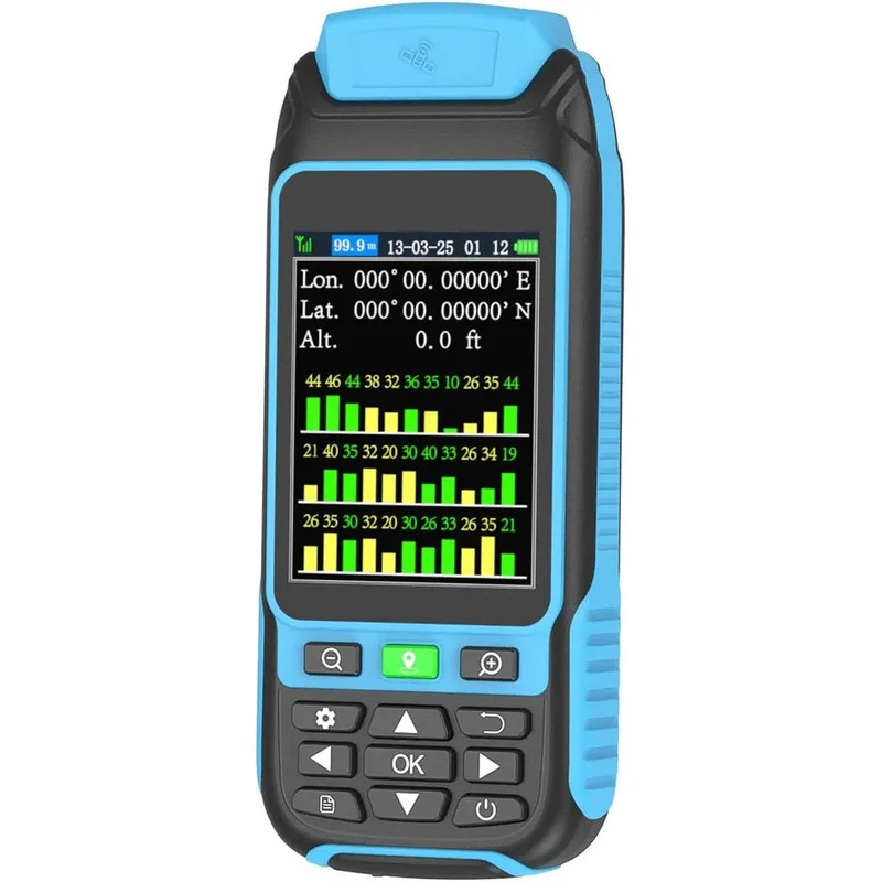
Beva Handheld Gps Survey Equipment High Precision Rugged Land Meter For Farmland Mountainous Terrain And Forest Mapping Model Nb88
Why you'll like it
- Enhanced Precision — Utilizes four global satellite systems, GPS, Beidou, GLONASS, and QZSS, to provide highly accurate area measurements within 0.002 acres.
- Versatile Field Functionality — Offers dedicated measurement modes for area, distance, and terrain slope, making it suitable for farmlands, forests, and uneven mining sites.
- Superior Outdoor Visibility — Equipped with a 3.2-inch anti-glare HD screen and a built-in backlight for clear data reading under direct sunlight or in dark environments.
- Rugged Durability — Features an IP-rated waterproof, dust-proof, and shock-resistant rubberized exterior designed to withstand tough outdoor job sites and storms.
- Portable Design — Crafted with an ergonomic, compact form factor that fits comfortably in your hand or pocket for effortless transport during long surveying sessions.
Product details
Description
The Beva NB88 Handheld GPS Survey Equipment is a professional-grade, ruggedized tool engineered for precise land measurement in challenging environments. Whether you are managing vast farmland, surveying mountainous terrain, navigating dense forests, or mapping mining lakes, this device provides the reliability required for accurate fieldwork.
It leverages an advanced quad-satellite positioning system, integrating GPS, Beidou, GLONASS, and QZSS to deliver ultra-accurate coordinates with a precision tolerance of within 0.002 acres. Designed for field operations, the device features a durable, waterproof, and dust-proof rubberized casing that ensures longevity even in harsh, muddy, or stormy conditions.
The 3.2-inch anti-glare TFT display remains clearly visible under bright midday sun or in low-light settings, supported by a dedicated backlight mode. Users can easily switch between specialized measurement modes to calculate area, distance, and terrain slope, making it a versatile instrument for agriculture, ranching, and environmental surveying.
This high-precision GPS land meter is an essential utility for professionals who demand consistent performance and portability in their survey workflows.
How to use
- Ensure the device is used outdoors in an open area with a clear view of the sky.
- Power on the unit and allow it to search for satellite signals for approximately five minutes before starting measurements.
- Once the data stops fluctuating and the precision unit displays below 1 meter, begin your survey.
- Select the appropriate terrain mode for your environment and walk the perimeter of the target area to record the data.
- Regular charging is recommended to maintain optimal battery life cycle.
Ingredients
This product is an electronic surveying device and does not contain chemical ingredients. It consists of high-grade ABS plastic, internal circuit boards, a lithium-ion rechargeable battery, and a rubberized silicone outer casing.
As printed by the brand. Check the pack label if you have an allergy.
Specifications
| Brand | BEVA |
|---|---|
| Ships from | USA (sourced directly), checked in Navi Mumbai |
| Sold by | Dropy.in |
Ratings & reviews
From our customers
FAQs
What is a handheld GPS device?
A handheld GPS device is a portable, ruggedized electronic instrument used to track geographical coordinates. It calculates precise area, distance, and slope measurements for outdoor environments like fields, forests, and remote landscapes.
What is the most accurate handheld GPS for surveying?
GPS surveying equipment consists of specialized instruments designed to calculate coordinates, area, perimeter, and elevation changes of land. These tools allow users to map terrain without the need for traditional, bulky land-surveying stations.
What is a GPS instrument for land survey?
Accuracy depends on the satellite constellations a device tracks. Units that connect to multiple networks, such as GPS, Beidou, and GLONASS like the Beva NB88, offer the highest reliability by maintaining a stable signal lock even in obstructed areas.
Are these products authentic USA imports?
Yes, all products sold by Dropy India are 100% authentic and imported directly from the USA. We source our inventory from authorized suppliers to ensure you receive genuine, high-quality equipment.
How do I maintain the accuracy of this survey device?
Always use the device in open spaces away from tall buildings or dense obstructions to ensure a strong satellite lock. Allow the signal to stabilize for at least five minutes before recording measurements to achieve maximum precision.
How long will delivery take?
Most orders arrive in 15–20 days: we source each product directly from the USA, check it at our Navi Mumbai warehouse and pack it on video. Items marked Dropy Express ship from our India warehouse and arrive in 3–5 days.
Is cash on delivery available?
Full cash on delivery is available all over India on Dropy Express items. For other orders from ₹2,499 to ₹15,000 you can use Partial COD: pay 25% online now and the rest in cash on delivery.
Are your products genuine?
Yes. Every product is 100% authentic, sourced directly from the USA, quality-checked and packed on video at our Navi Mumbai warehouse.
What if my order arrives damaged or wrong?
Write to us at [email protected] as soon as it arrives. Damaged, wrong or not as described, our Buyer Protection gives you a full refund. The details are in our Return, Refund & Cancellation Policy.
Is delivery free?
Delivery is free on orders from ₹1,499. Below that a ₹79 delivery fee applies.