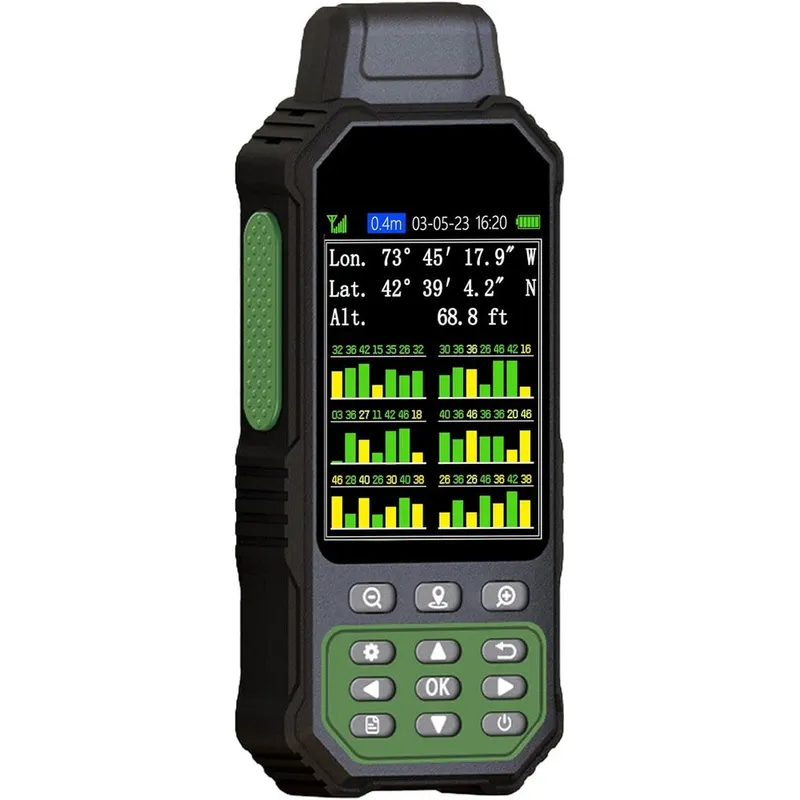
NiesahYan ZL190PLUS Handheld GPS Land Surveying Equipment With 3.2 Inch Color Screen And Multi-GNSS Support For Area And Slope Measurement
Why you'll like it
- High Precision Measurement — Supports multiple satellite constellations including GPS, Beidou, and Galileo to ensure accurate data tracking in various outdoor terrains.
- Versatile Functionality — Features seven measurement modes for calculating flat and slope areas, straight or curved line distances, height, and saving coordinate points.
- Exceptional Display Clarity — Includes a 3.2-inch sunlight-readable color screen with a 240 by 320 pixel resolution for easy reading in bright, direct light.
- Extended Battery Performance — Powered by a high-capacity 4000 milliampere-hour rechargeable lithium-ion battery providing up to 48 hours of continuous use for long field days.
- Rugged Design — Built for demanding environments, the device features a durable housing and an intuitive interface with backlit buttons for reliable operation.
Product details
Description
The NiesahYan ZL190PLUS is a professional-grade handheld GPS land surveying tool designed for high-precision field measurements. Engineered for surveyors, farmers, and land managers, this device simplifies complex calculations in rugged outdoor environments. Whether you are measuring farmland, gardens, mountainous terrain, or sloped fields, the ZL190PLUS provides the reliability needed for accurate site analysis.
Equipped with a vivid 3.2-inch sunlight-readable color display, this device ensures excellent visibility even in bright outdoor conditions. The unit supports multi-GNSS constellation tracking, including GPS, Beidou, and Galileo, to maintain high precision. With seven distinct measurement modes, users can easily calculate flat and slope areas, straight and curved line distances, height, and record coordinate points. The device is powered by an internal 4000 milliampere-hour rechargeable lithium-ion battery, delivering up to 48 hours of continuous operation on a single charge. Its intuitive interface and backlit buttons allow for quick, seamless operation in the field. Built for durability, this compact and lightweight tool is essential for anyone requiring accurate, portable land measurement solutions.
How to use
- To begin, ensure you are in an open outdoor area with an unobstructed view of the sky, as the device cannot receive satellite signals indoors.
- Power on the unit and wait for the satellite signal icon in the upper left corner of the screen to stabilize, indicating an accuracy below one meter.
- Select your desired mode from the main menu, such as flat area, slope area, or distance.
- Hold the device with the screen facing upward and walk the perimeter of the area or along the target path as prompted by the interface to begin recording data.
Ingredients
This device contains electronic components including a 4000 milliampere-hour rechargeable lithium-ion battery, internal GNSS receiver modules, a 3.2-inch TFT color display, and a durable plastic exterior housing.
As printed by the brand. Check the pack label if you have an allergy.
Specifications
| Brand | NiesahYan |
|---|---|
| EAN | 8711871190487 |
| Ships from | USA (sourced directly), checked in Navi Mumbai |
| Sold by | Dropy.in |
Ratings & reviews
From our customers
FAQs
Can this GPS device be used indoors for land measurement?
No, the ZL190PLUS must be used outdoors with an unobstructed view of the sky. It requires a clear signal from satellite constellations to function correctly and will not work inside buildings.
What kind of terrain is this land surveying equipment suitable for?
This tool is versatile and suitable for a variety of landscapes, including farmland, gardens, mountainous sites, sloped fields, and large ranches.
How long does the battery last on a single charge?
The device is equipped with a 4000 milliampere-hour rechargeable lithium-ion battery that provides up to 48 hours of continuous use in the field.
Are these products authentic and sourced from the USA?
Yes, all beauty, health, and personal care products available at Dropy India are authentic imports sourced directly from the USA to ensure high quality for our customers.
Does the device support multiple satellite systems?
Yes, the ZL190PLUS features multi-GNSS support, allowing it to connect to several satellite constellations including GPS, Beidou, Galileo, and QZSS for improved precision.
How long will delivery take?
Most orders arrive in 15–20 days: we source each product directly from the USA, check it at our Navi Mumbai warehouse and pack it on video. Items marked Dropy Express ship from our India warehouse and arrive in 3–5 days.
Is cash on delivery available?
Full cash on delivery is available all over India on Dropy Express items. For other orders from ₹2,499 to ₹15,000 you can use Partial COD: pay 25% online now and the rest in cash on delivery.
Are your products genuine?
Yes. Every product is 100% authentic, sourced directly from the USA, quality-checked and packed on video at our Navi Mumbai warehouse.
What if my order arrives damaged or wrong?
Write to us at [email protected] as soon as it arrives. Damaged, wrong or not as described, our Buyer Protection gives you a full refund. The details are in our Return, Refund & Cancellation Policy.
Is delivery free?
Delivery is free on orders from ₹1,499. Below that a ₹79 delivery fee applies.