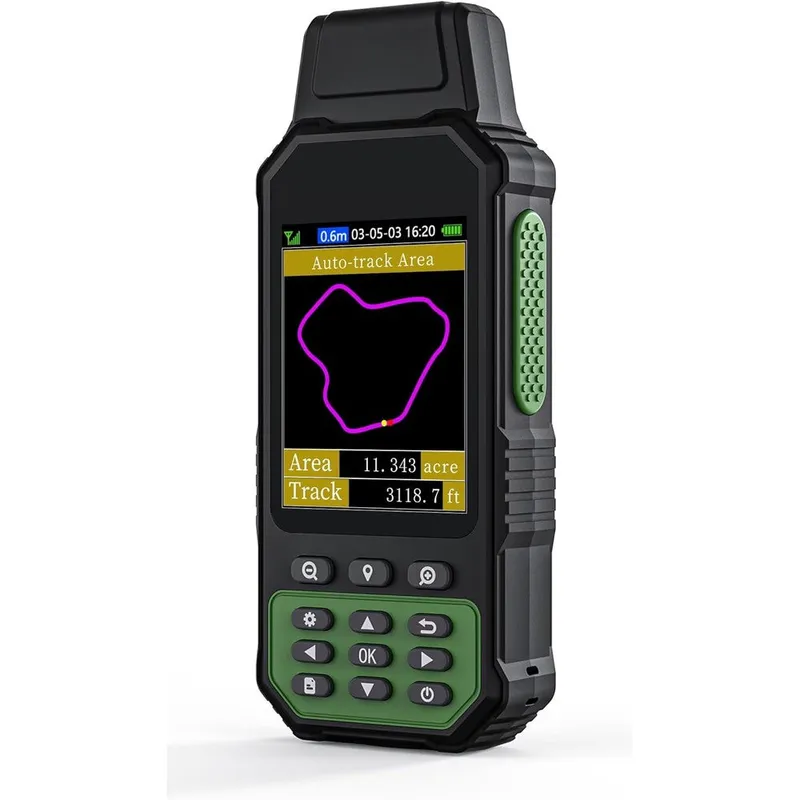
NiesahYan ZL190PLUS Handheld GPS For Surveying And Land Measurement High Precision Rugged Land Surveying Equipment For Outdoor Terrain
Why you'll like it
- High Precision Measurement — Utilizes multi-GNSS support with GPS, Beidou, Glonass, and QZSS for accurate area and distance calculations in complex terrains.
- Rugged Durability — Features an IP65 waterproof and dust-proof rating to withstand harsh outdoor working environments on farms or ranches.
- Enhanced Visibility — Equipped with a 3.2-inch TFT backlit display that allows for clear data reading in bright daylight or low-light conditions.
- Versatile Operation — Offers multiple measurement modes for irregular shapes, flat land, and slope distances, powered by a long-lasting 4000 mAh battery.
- Portable Design — Ergonomic handheld form factor includes a wrist strap for steady measurement and easy transport across vast fields or agricultural plots.
Product details
Description
Simplify complex land measurements with the NiesahYan ZL190PLUS, a high-precision handheld GPS unit engineered for professionals and landowners. Designed to operate in demanding outdoor environments, this rugged device provides accurate data for farmland, ranches, parking areas, and hilly terrain. Whether you are mapping irregular plots, calculating slope distances, or measuring acreage, this unit delivers reliable results using advanced multi-GNSS satellite support, including GPS, Beidou, Glonass, and QZSS.
The ZL190PLUS features a clear 3.2-inch TFT backlit screen, ensuring readability even in challenging lighting conditions. Its IP65-rated waterproof and dust-proof construction protects internal components from the elements, making it an ideal companion for agricultural tasks. Equipped with a powerful 4000 mAh battery, it offers long-lasting performance for extended surveying sessions. This tool is built for direct measurement—simply walk the perimeter of your terrain to capture accurate area and track length data. Its portable, ergonomic design fits comfortably in the hand or pocket, with an included wrist strap for added security during operation. Perfect for those who need a dedicated, professional-grade solution for efficient land management and surveying projects.
How to use
- Power on the device in an open, outdoor area free from overhead obstructions and allow it to search for satellites for approximately 5 minutes.
- Wait until the precision indicator in the upper left corner of the screen shows a value below 1 meter.
- Hold the device horizontally at a consistent height while walking the perimeter of the terrain to begin measuring.
- For best accuracy, it is recommended to measure areas larger than 0.16 acres and distances exceeding 328 feet.
Ingredients
Not applicable as this is an electronic surveying device.
As printed by the brand. Check the pack label if you have an allergy.
Specifications
| Brand | NiesahYan |
|---|---|
| EAN | 8711871396025 |
| Ships from | USA (sourced directly), checked in Navi Mumbai |
| Sold by | Dropy.in |
Ratings & reviews
From our customers
FAQs
What specific terrain is this GPS used for?
This device is versatile and can be used for surveying a variety of terrains, including farmlands, gardens, pastures, mountainous areas, sloping fields, and parking lots.
Can this device be used for vehicle navigation?
No, the ZL190PLUS is designed strictly for land surveying and area calculation purposes. It does not provide turn-by-turn navigation or road routing.
What is the accuracy of the ZL190PLUS?
The device provides high-precision tracking with an area measurement error margin as low as 0.002 acres, provided the signal is locked with a precision of less than 1 meter.
Are the products sold on Dropy authentic imports?
Yes, Dropy India specializes in authentic USA-imported goods. We source our products directly to ensure you receive genuine high-quality equipment.
Does the altitude data change?
Yes, the altitude displayed is GPS-based and will naturally fluctuate with changes in satellite signal reception during your operation.
How long will delivery take?
Most orders arrive in 15–20 days: we source each product directly from the USA, check it at our Navi Mumbai warehouse and pack it on video. Items marked Dropy Express ship from our India warehouse and arrive in 3–5 days.
Is cash on delivery available?
Full cash on delivery is available all over India on Dropy Express items. For other orders from ₹2,499 to ₹15,000 you can use Partial COD: pay 25% online now and the rest in cash on delivery.
Are your products genuine?
Yes. Every product is 100% authentic, sourced directly from the USA, quality-checked and packed on video at our Navi Mumbai warehouse.
What if my order arrives damaged or wrong?
Write to us at [email protected] as soon as it arrives. Damaged, wrong or not as described, our Buyer Protection gives you a full refund. The details are in our Return, Refund & Cancellation Policy.
Is delivery free?
Delivery is free on orders from ₹1,499. Below that a ₹79 delivery fee applies.